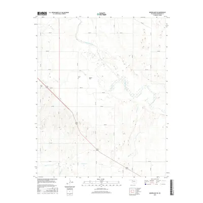
2016 Map of Mooreland SW
USGS Topo · Published 2016About this map
Moscow Flats and the meandering course of the North Canadian River define this Woodward County landscape. The map illustrates a rural environment shaped by natural drainage systems, including Persimmon Creek, Indian Creek, and Sand Creek. Settlement patterns are marked by quiet landmarks such as Moscow Cemetery and North Chapel Cemetery, which provide valuable anchor points for genealogical research in this part of Oklahoma. The land is organized by an extensive grid of section-line roads, such as E0450 Road and N2140 Road, reflecting the traditional township and range survey system. This 2016 edition provides a modern topographic record of the area's hydrology and small-scale landmarks, documenting the enduring rural character of the terrain just southwest of Mooreland.
Find a feature on this map
26 named features on this map. Tap any name to fly to it.
Don’t see what you’re looking for? This feature index may not catch every label — zoom into the map to look around manually.
Map Details
Editions of this 2016 Mooreland SW Map
This is the sole edition of this map. No revisions or reprints were ever made.
Other maps of this area

1955 · Woodward
USGS Topo · 1:250,000

1958 · Woodward
USGS Topo · 1:250,000

1969 · Mooreland SE
USGS Topo · 1:24,000

1969 · Quinlan
USGS Topo · 1:24,000

1969 · Mooreland
USGS Topo · 1:24,000

1969 · Sharon
USGS Topo · 1:24,000

1969 · Woodward NE
USGS Topo · 1:24,000

1969 · Mooreland SW
USGS Topo · 1:24,000

1969 · Mutual
USGS Topo · 1:24,000

1969 · Vici
USGS Topo · 1:24,000