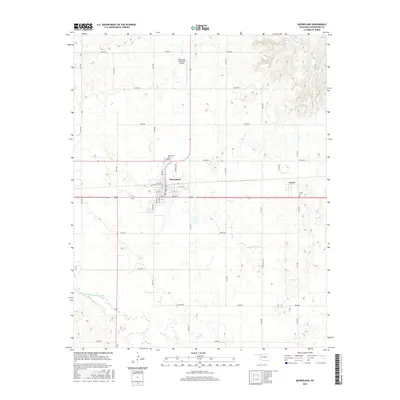
2016 Map of Mooreland
USGS Topo · Published 2016About this map
Mooreland serves as the primary hub of this Woodward County landscape, centered at the intersection of a sprawling rural road grid and the railroad line. The town's layout is meticulously detailed, showing local thoroughfares like S Elm St, S Laird, and Wilkie Rd. Beyond the town limits, the terrain transitions into the hydraulic patterns of the North Canadian River valley to the south and the dissected uplands near Wheelock Reservoir to the northeast. Small-scale water features such as Sand Cr and Bull Cr carve through the section-line landscape, which remains largely defined by agricultural allotments. The presence of both the Mooreland Cem and the Curtis Cem near the smaller settlement of Curtis provides specific points of interest for genealogists tracing families in the eastern portion of the quadrangle near N2170 Rd.
Find a feature on this map
39 named features on this map. Tap any name to fly to it.
Don’t see what you’re looking for? This feature index may not catch every label — zoom into the map to look around manually.
Map Details
Editions of this 2016 Mooreland Map
This is the sole edition of this map. No revisions or reprints were ever made.
Other maps of this area

1955 · Woodward
USGS Topo · 1:250,000

1958 · Woodward
USGS Topo · 1:250,000

1969 · Mooreland SE
USGS Topo · 1:24,000

1969 · Quinlan
USGS Topo · 1:24,000

1969 · Mooreland
USGS Topo · 1:24,000

1969 · Sharon
USGS Topo · 1:24,000

1969 · Woodward NE
USGS Topo · 1:24,000

1969 · Mooreland SW
USGS Topo · 1:24,000

1970 · Fairvalley SW
USGS Topo · 1:24,000

1970 · Fairvalley SE
USGS Topo · 1:24,000