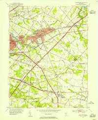
1953 Map of Moorestown
USGS Topo · Published 1954About this map
The town of Moorestown and its surrounding townships define this mid-century landscape as suburban development began to intersect with the region's agricultural roots. The newly constructed New Jersey Turnpike cuts a diagonal path through the area, contrasting with older transportation routes like the Pennsylvania Railroad and the historic Kings Highway. Institutional landmarks are prominent, including the USDA Research Lab and the Immaculate Conception Novitiate, alongside several local township schools like Township Sch No 7 and Township Sch No 3. In the south, the Cooper River and Cropwell Brook wind through more open terrain near Marlton, where the Marlton-Medford Airfield and the Wiley Mission represent the diverse uses of the land. This era captures the transition of Burlington County from rural crossroads like Evesboro and Fellowship toward more integrated residential communities.
Find a feature on this map
76 named features on this map. Tap any name to fly to it.
Don’t see what you’re looking for? This feature index may not catch every label — zoom into the map to look around manually.
Map Details
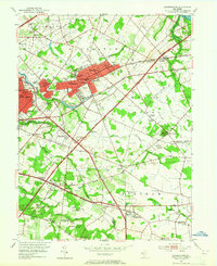
Editions of this 1953 Moorestown Map
2 editions found
Other maps of this area

1888 · Mount Holly
USGS Topo · 1:62,500

1890 · Burlington
USGS Topo · 1:62,500

1891 · Philadelphia
USGS Topo · 1:62,500

1893 · Germantown
USGS Topo · 1:62,500

1893 · Burlington
USGS Topo · 1:62,500

1894 · Mount Holly
USGS Topo · 1:62,500

1894 · Philadelphia
USGS Topo · 1:62,500

1894 · Germantown
USGS Topo · 1:62,500

1896 · Germantown
USGS Topo · 1:62,500

1896 · Philadelphia
USGS Topo · 1:62,500
Featured Places
- Cherry Hill Township, NJ
- Mount Laurel Township, NJ
- Willingboro Township, NJ
- Moorestown Township, NJ
- Maple Shade Township, NJ