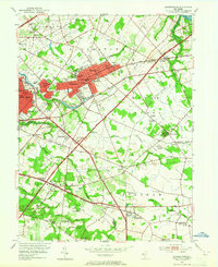
1953 Map of Moorestown
USGS Topo · Published 1965About this map
Moorestown and Maple Shade serve as the primary residential hubs in this mid-century survey of the suburban landscape between the Pennsauken Creek and the Cooper River. The area is defined by a dense network of institutional landmarks, including the USDA Research Lab and several religious estates such as the Immaculate Conception Novitiate and St Marys Home For the Aged. Outside the developed cores, smaller communities like Marlton, Evesboro, and Fellowship dot the landscape near the New Jersey Toll Road Turnpike. Local heritage is preserved in the numerous church properties and burial grounds like Jacobs Chapel, Colestown Cemetery, and Eldridge Cem. The Pennsylvania Railroad and Rockefeller Memorial Highway provide the critical infrastructure connecting these growing townships, while Strawbridge Lake and Mount Laurel offer distinct geographical anchors amidst the expanding residential blocks and local schools like Baker Sch and Sharp Sch.
Find a feature on this map
70 named features on this map. Tap any name to fly to it.
Don’t see what you’re looking for? This feature index may not catch every label — zoom into the map to look around manually.
Map Details
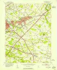
Editions of this 1953 Moorestown Map
2 editions found
Other maps of this area

1888 · Mount Holly
USGS Topo · 1:62,500

1890 · Burlington
USGS Topo · 1:62,500

1891 · Philadelphia
USGS Topo · 1:62,500

1893 · Germantown
USGS Topo · 1:62,500

1893 · Burlington
USGS Topo · 1:62,500

1894 · Mount Holly
USGS Topo · 1:62,500

1894 · Philadelphia
USGS Topo · 1:62,500

1894 · Germantown
USGS Topo · 1:62,500

1896 · Germantown
USGS Topo · 1:62,500

1896 · Philadelphia
USGS Topo · 1:62,500
Featured Places
- Cherry Hill Township, NJ
- Mount Laurel Township, NJ
- Willingboro Township, NJ
- Moorestown Township, NJ
- Maple Shade Township, NJ