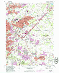
1966 Map of Moorestown
USGS Topo · Published 1986About this map
Moorestown and the surrounding townships of Mount Laurel and Cherry Hill show significant residential expansion during the mid-1960s, a trend tracked further through purple revisions into the early 1980s. The landscape is a mix of established borough centers and emerging subdivisions like Kingston Estates, Barclay Farm, and Heritage Village. This era of growth is anchored by major transportation corridors, including the New Jersey Turnpike and the Garden State Parkway, which shaped the commercial development of the region, notably seen at the Moorestown Mall Shopping Center.
Find a feature on this map
87 named features on this map. Tap any name to fly to it.
Don’t see what you’re looking for? This feature index may not catch every label — zoom into the map to look around manually.
Map Details
Editions of this 1966 Moorestown Map
Other maps of this area

1888 · Mount Holly
USGS Topo · 1:62,500

1890 · Burlington
USGS Topo · 1:62,500

1891 · Philadelphia
USGS Topo · 1:62,500

1893 · Germantown
USGS Topo · 1:62,500

1893 · Burlington
USGS Topo · 1:62,500

1894 · Mount Holly
USGS Topo · 1:62,500

1894 · Philadelphia
USGS Topo · 1:62,500

1894 · Germantown
USGS Topo · 1:62,500

1896 · Germantown
USGS Topo · 1:62,500

1896 · Philadelphia
USGS Topo · 1:62,500
Featured Places
- Cherry Hill Township, NJ
- Mount Laurel Township, NJ
- Willingboro Township, NJ
- Moorestown Township, NJ
- Maple Shade Township, NJ