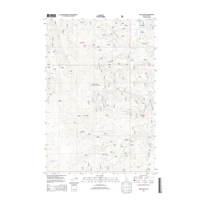
2013 Map of Moose Butte
USGS Topo · Published 2013About this map
Nez Perce National Forest defines this high-elevation landscape in Idaho County, where a complex network of tributaries feeds into the major branches of the Red River. The geography is anchored by prominent peaks including Moose Butte, Porters Mtn, and Jack Mtn, the latter reached by the Jack Mtn Rd. While much of the area remains undeveloped wilderness, small named settlements and properties like Gibler, Leprouse, and the Little Ponderosa Ranch are clustered in the northern portion of the quadrangle along the river valley. This 2013 survey provides a clear view of the forest road system, including Nat For Dev Rd 1800, as it navigates the steep drainages of Silver Cr, Deer Cr, and Moose Meadow Cr. The map's layout highlights the convergence of the W Fork Red River, Middle Fork Red River, and S Fork Red River, showing how water and topography dictated the placement of early mountain outposts.
Find a feature on this map
36 named features on this map. Tap any name to fly to it.
Don’t see what you’re looking for? This feature index may not catch every label — zoom into the map to look around manually.
Map Details
Editions of this 2013 Moose Butte Map
This is the sole edition of this map. No revisions or reprints were ever made.
Other maps of this area

1931 · Buffalo Hump
USGS Topo · 1:125,000

1934 · Buffalo Hump
USGS Topo · 1:125,000

1956 · Elk City
USGS Topo · 1:250,000

1960 · Elk City
USGS Topo · 1:250,000

1962 · Center Star Mtn
USGS Topo · 1:24,000

1966 · Elk City
USGS Topo · 1:24,000

1966 · Black Hawk Mtn
USGS Topo · 1:24,000

1977 · Silver Spur Ridge
USGS Topo · 1:24,000

1978 · Moose Butte
USGS Topo · 1:24,000

1978 · Trapper Creek
USGS Topo · 1:24,000