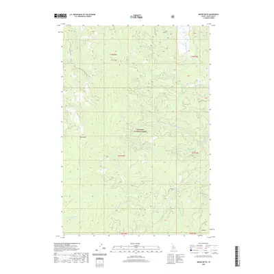
2020 Map of Moose Butte
USGS Topo · Published 2020About this map
Nez Perce National Forest dominates this Idaho County landscape, showcasing a complex network of mountain drainages and high ridges. The area is defined by the headwaters of the Red River, where the Middle Fork Red River, S Fork Red River, and W Fork Red River converge amidst steep terrain. This map documents a series of National Forest Development Roads, such as Nat For Dev Rd 1803 and Nat For Dev Rd 1800, which provide the primary access to these remote reaches.
Find a feature on this map
34 named features on this map. Tap any name to fly to it.
Don’t see what you’re looking for? This feature index may not catch every label — zoom into the map to look around manually.
Map Details
Editions of this 2020 Moose Butte Map
This is the sole edition of this map. No revisions or reprints were ever made.
Other maps of this area

1931 · Buffalo Hump
USGS Topo · 1:125,000

1934 · Buffalo Hump
USGS Topo · 1:125,000

1956 · Elk City
USGS Topo · 1:250,000

1960 · Elk City
USGS Topo · 1:250,000

1962 · Center Star Mtn
USGS Topo · 1:24,000

1966 · Elk City
USGS Topo · 1:24,000

1966 · Black Hawk Mtn
USGS Topo · 1:24,000

1977 · Silver Spur Ridge
USGS Topo · 1:24,000

1978 · Moose Butte
USGS Topo · 1:24,000

1978 · Trapper Creek
USGS Topo · 1:24,000