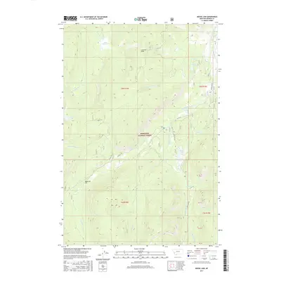
2017 Map of Moose Lake
USGS Topo · Published 2017About this map
Deerlodge National Forest encompasses the high country of Granite County, where a network of mountain drainages feeds the Middle Fork Rock Creek. The landscape is defined by its many alpine waters, including Kaiser Lake, Whetstone Lake, and Susie Lake, situated amidst prominent terrain features like Lone Pine Ridge and Sagebrush Flat. This 2017 survey shows a region where human passage is largely defined by forestry roads like Co RD 80 and Co RD 5141. The drainage pattern is complex, with Moose Meadow Cr and Senate Cr carving through the northern sections while Carpp Cr and Falls Fork Rock Cr gather in the south. The placement of Zekes Meadows and Moose Lake highlights the significant riparian zones that support the area's local ecosystem within the national forest boundaries.
Find a feature on this map
27 named features on this map. Tap any name to fly to it.
Don’t see what you’re looking for? This feature index may not catch every label — zoom into the map to look around manually.
Map Details
Editions of this 2017 Moose Lake Map
This is the sole edition of this map. No revisions or reprints were ever made.
Other maps of this area

1908 · Philipsburg
USGS Topo · 1:125,000

1909 · Sapphire
USGS Topo · 1:125,000

1947 · Butte
USGS Topo · 1:250,000

1955 · Dillon
USGS Topo · 1:250,000

1957 · Dillon
USGS Topo · 1:250,000

1958 · Butte
USGS Topo · 1:250,000

1958 · Dillon
USGS Topo · 1:250,000

1960 · Butte
USGS Topo · 1:250,000

1962 · Butte
USGS Topo · 1:250,000

1962 · Dillon
USGS Topo · 1:250,000