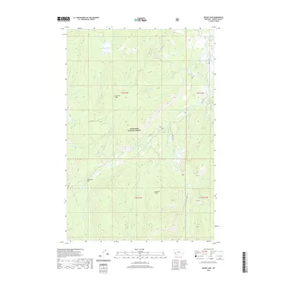
2020 Map of Moose Lake
USGS Topo · Published 2020About this map
Deerlodge National Forest encompasses this section of Granite County, where high-altitude drainage systems feed into the Middle Fork Rock Creek. The landscape is defined by the northern reaches of the Anaconda Range, featuring prominent terrain markers like Lone Pine Ridge and the broad Sagebrush Flat. This 2020 survey illustrates a complex network of alpine water bodies, including Moose Lake, Susie Lake, Kaiser Lake, and Whetstone Lake, which serve as the headwaters for numerous named tributaries.
Find a feature on this map
34 named features on this map. Tap any name to fly to it.
Don’t see what you’re looking for? This feature index may not catch every label — zoom into the map to look around manually.
Map Details
Editions of this 2020 Moose Lake Map
This is the sole edition of this map. No revisions or reprints were ever made.
Other maps of this area

1908 · Philipsburg
USGS Topo · 1:125,000

1909 · Sapphire
USGS Topo · 1:125,000

1947 · Butte
USGS Topo · 1:250,000

1955 · Dillon
USGS Topo · 1:250,000

1957 · Dillon
USGS Topo · 1:250,000

1958 · Butte
USGS Topo · 1:250,000

1958 · Dillon
USGS Topo · 1:250,000

1960 · Butte
USGS Topo · 1:250,000

1962 · Butte
USGS Topo · 1:250,000

1962 · Dillon
USGS Topo · 1:250,000