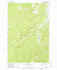
1974 Map of Moose Lake
USGS Topo · Published 1977About this map
Banner Mine and the Old Dominion Mine sit nestled within the high country of the Deerlodge National Forest, representing the extractive history of Granite County. This mid-1970s survey captures a landscape defined by its complex drainage systems, where the Middle Fork Rock Creek and Copper Creek carve through steep terrain. The presence of the Anaconda Pintlar Wilderness boundary at the southern edge of the map highlights a transition toward protected wildlands, while several pack trails and jeep tracks suggest the continued importance of back-country access for both resource management and recreation.
Find a feature on this map
33 named features on this map. Tap any name to fly to it.
Don’t see what you’re looking for? This feature index may not catch every label — zoom into the map to look around manually.
Map Details
Editions of this 1974 Moose Lake Map
This is the sole edition of this map. No revisions or reprints were ever made.
Other maps of this area

1908 · Philipsburg
USGS Topo · 1:125,000

1909 · Sapphire
USGS Topo · 1:125,000

1947 · Butte
USGS Topo · 1:250,000

1955 · Dillon
USGS Topo · 1:250,000

1957 · Dillon
USGS Topo · 1:250,000

1958 · Butte
USGS Topo · 1:250,000

1958 · Dillon
USGS Topo · 1:250,000

1960 · Butte
USGS Topo · 1:250,000

1962 · Butte
USGS Topo · 1:250,000

1962 · Dillon
USGS Topo · 1:250,000