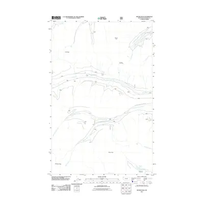
2011 Map of Moose Peak
USGS Topo · Published 2011About this map
The Whitefish Range dominates this corner of Flathead County, defined by a complex drainage system and prominent high-elevation landmarks. Coal Ridge stretches across the northern section, anchored by the Coal Ridge Lookout Tower, which provides a strategic vantage point over the converging valleys of Coal Creek and its southern fork. The terrain is marked by significant peaks, including Moran Peak and the central Moose Peak, which towers over the southern drainages.
Find a feature on this map
18 named features on this map. Tap any name to fly to it.
Don’t see what you’re looking for? This feature index may not catch every label — zoom into the map to look around manually.
Map Details
Editions of this 2011 Moose Peak Map
This is the sole edition of this map. No revisions or reprints were ever made.
Other maps of this area

1906 · Kintla Lakes
USGS Topo · 1:125,000

1913 · Stryker
USGS Topo · 1:125,000

1916 · Stryker
USGS Topo · 1:125,000

1938 · Kintla Lakes
USGS Topo · 1:125,000

1957 · Kalispell
USGS Topo · 1:250,000

1960 · Kalispell
USGS Topo · 1:250,000

1961 · Kalispell
USGS Topo · 1:250,000

1966 · Red Meadow Lake
USGS Topo · 1:24,000
1966 · Olney
USGS Topo · 1:24,000
1966 · Skookoleel Creek
USGS Topo · 1:24,000