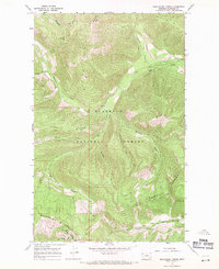
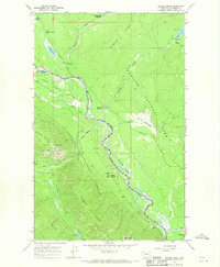
1966 Map of Skookoleel Creek
USGS Topo · Published 1971About this map
The high mountain reaches of the Whitefish Range and Smoky Range dominate this 1960s landscape north of Columbia Falls. In this era, the terrain is defined by a dense network of drainage systems and primitive access routes rather than developed roads. The prominent Flathead National Forest boundary encompasses a series of steep drainages including Skookoleel Creek, Nicola Creek, and Kinnikinnick Creek, which feed into the larger Big Creek. High-elevation observation points such as Forks Lookout and Smoky Lookout Tower emphasize the strategic importance of fire monitoring across these heavily timbered ridges. The presence of Big Mountain in the southwest corner and the winding Dead Horse Ridge illustrate the complex topography that historically constrained movement through this part of the northern Rockies, where travel was primarily limited to various segments of Pack Trail.
Find a feature on this map
24 named features on this map. Tap any name to fly to it.
Don’t see what you’re looking for? This feature index may not catch every label — zoom into the map to look around manually.
Map Details
Editions of this 1966 Skookoleel Creek Map
2 editions found
Other maps of this area

1906 · Kintla Lakes
USGS Topo · 1:125,000

1938 · Kintla Lakes
USGS Topo · 1:125,000

1943 · Kalispell
USGS Topo · 1:125,000

1957 · Kalispell
USGS Topo · 1:250,000

1960 · Kalispell
USGS Topo · 1:250,000

1961 · Kalispell
USGS Topo · 1:250,000

1962 · Beaver Lake
USGS Topo · 1:24,000
1962 · Whitefish
USGS Topo · 1:24,000
1962 · Columbia Falls North
USGS Topo · 1:24,000
1966 · Demers Ridge
USGS Topo · 1:24,000