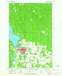
1962 Map of Whitefish
USGS Topo · Published 1964About this map
The Whitefish Range rises sharply above the developed grid of Whitefish, where the mid-century layout of this mountain community is captured in detail. The settlement serves as a critical hub for both recreation and industry, anchored by the Great Northern railroad line and the expanding Big Mountain Ski Resort to the north. In town, the map identifies civic and social landmarks including the National Guard Armory, Memorial Sch, and the Whitefish City Beach on the southern shore of Whitefish Lake.
Find a feature on this map
45 named features on this map. Tap any name to fly to it.
Don’t see what you’re looking for? This feature index may not catch every label — zoom into the map to look around manually.
Map Details
Editions of this 1962 Whitefish Map
3 editions found
Other maps of this area

1906 · Kintla Lakes
USGS Topo · 1:125,000

1938 · Kintla Lakes
USGS Topo · 1:125,000

1943 · Kalispell
USGS Topo · 1:125,000

1957 · Kalispell
USGS Topo · 1:250,000

1960 · Kalispell
USGS Topo · 1:250,000

1961 · Kalispell
USGS Topo · 1:250,000

1962 · Columbia Falls South
USGS Topo · 1:24,000

1962 · Rose Crossing
USGS Topo · 1:24,000

1962 · Beaver Lake
USGS Topo · 1:24,000

1962 · Rhodes
USGS Topo · 1:24,000