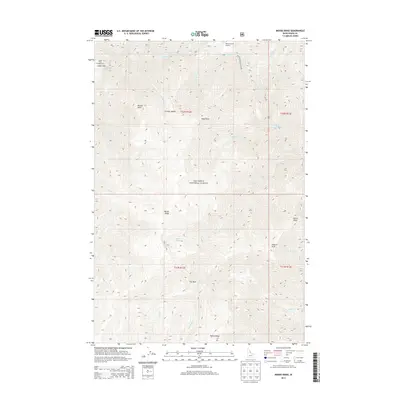
2013 Map of Moose Ridge
USGS Topo · Published 2013About this map
Nez Perce National Forest encompasses this high-elevation landscape in Idaho County, centered on the prominent spine of Moose Ridge. The Selway River flows through the northern reaches of the quadrangle, navigating significant whitewater at Double Drop Rapids near Cedar Flats. This 2013 survey details a remote wilderness area where transportation is limited to the Moose Creek Airport and a network of named trails connecting points such as Patrol Point and Shearer Peak. The drainage patterns are intricate, with numerous creeks like Hell Cr and Lonesome Cr carving the terrain between Wylies Ridge and Tony Point. Genealogists and historians can use these specific landmarks to trace early forest service activity and the geographical context of back-country Idaho, including isolated features like Bitch Lake and the open high-country meadow at Fox Park.
Find a feature on this map
31 named features on this map. Tap any name to fly to it.
Don’t see what you’re looking for? This feature index may not catch every label — zoom into the map to look around manually.
Map Details
Editions of this 2013 Moose Ridge Map
This is the sole edition of this map. No revisions or reprints were ever made.
Other maps of this area

1911 · Lolo
USGS Topo · 1:250,000

1913 · Lolo
USGS Topo · 1:250,000

1956 · Elk City
USGS Topo · 1:250,000

1956 · Hamilton
USGS Topo · 1:250,000

1959 · Hamilton
USGS Topo · 1:250,000

1960 · Elk City
USGS Topo · 1:250,000

1960 · Hamilton
USGS Topo · 1:250,000

1964 · Hamilton
USGS Topo · 1:250,000

1966 · Moose Ridge
USGS Topo · 1:24,000

1966 · Dog Creek
USGS Topo · 1:24,000