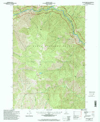
1995 Map of Moose Ridge
USGS Topo · Published 1999About this map
Moose Ridge anchors this 1990s topographic landscape, where the Middle Fork Selway River and the Wild and Scenic River Selway River converge in a high-elevation backcountry environment. Managed by the U.S. Forest Service, this region within the Nez Perce National Forest and the Selway Bitterroot Wilderness is defined by its lack of road infrastructure, relying instead on the Moose Creek Airstrip for access. Notable vertical landmarks include Shearer Peak, Tony Point, and Patrol Point, which overlook a network of drainages such as Bitch Creek and Lonesome Creek. The map documents a strictly protected wilderness area in the mid-1990s, capturing the specific geography of remote high-country water sources like Bitch Lake and the ridgeline trails used for forest management and fire lookout placement.
Find a feature on this map
31 named features on this map. Tap any name to fly to it.
Don’t see what you’re looking for? This feature index may not catch every label — zoom into the map to look around manually.
Map Details
Editions of this 1995 Moose Ridge Map
This is the sole edition of this map. No revisions or reprints were ever made.
Other maps of this area

1911 · Lolo
USGS Topo · 1:250,000

1913 · Lolo
USGS Topo · 1:250,000

1956 · Elk City
USGS Topo · 1:250,000

1956 · Hamilton
USGS Topo · 1:250,000

1959 · Hamilton
USGS Topo · 1:250,000

1960 · Elk City
USGS Topo · 1:250,000

1960 · Hamilton
USGS Topo · 1:250,000

1964 · Hamilton
USGS Topo · 1:250,000

1966 · Moose Ridge
USGS Topo · 1:24,000

1966 · Dog Creek
USGS Topo · 1:24,000