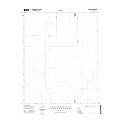
2016 Map of Moran Ranch
USGS Topo · Published 2016About this map
Moran Ranch sits at the heart of this high plains landscape along the jurisdictional boundary of Hartley and Moore Counties. The terrain is characterized by a sprawling grid of rural infrastructure, reflecting the large-scale ranching and agricultural operations typical of the Texas Panhandle. Unlike many regions defined by natural waterways, this area relies on a geometric network of county roads including Co Rd 47, Farm Store Rd, and Countyline Rd. The map illustrates the sparse settlement pattern of the mid-2010s, where named locations are often tied to specific large landholdings rather than dense townships. Notable thoroughfares such as W Rd G and W Rd I provide the primary connectivity across these wide-open pastures and cultivated fields.
Find a feature on this map
13 named features on this map. Tap any name to fly to it.
Don’t see what you’re looking for? This feature index may not catch every label — zoom into the map to look around manually.
Map Details
Editions of this 2016 Moran Ranch Map
This is the sole edition of this map. No revisions or reprints were ever made.
Other maps of this area

1954 · Tucumcari
USGS Topo · 1:250,000

1954 · Dalhart
USGS Topo · 1:250,000

1958 · Tucumcari
USGS Topo · 1:250,000

1958 · Dalhart
USGS Topo · 1:250,000

1962 · Dalhart
USGS Topo · 1:250,000

1963 · Hartley SE
USGS Topo · 1:24,000

1963 · Hartley NE
USGS Topo · 1:24,000

1963 · Bird Ranch Store
USGS Topo · 1:24,000

1963 · Stallwitz Lake
USGS Topo · 1:24,000

1963 · Moran Ranch
USGS Topo · 1:24,000