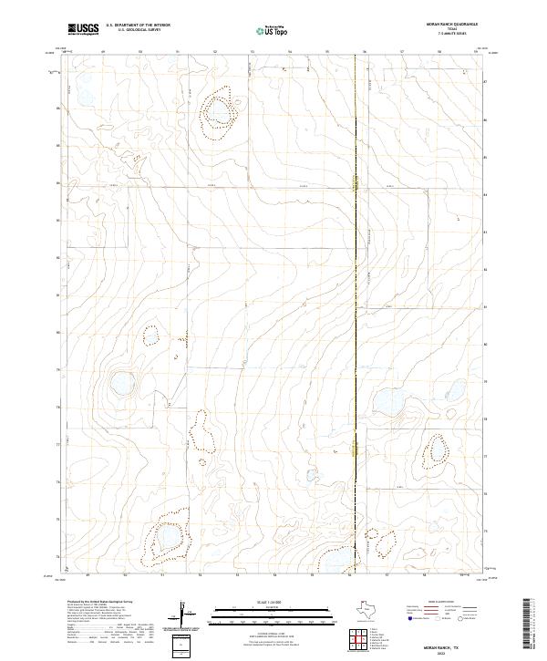
2022 Map of Moran Ranch
USGS Topo · Published 2022About this map
Hartley Co and Moore Co share a long north-south boundary through this high plains ranching landscape in the Texas Panhandle. The terrain is defined by wide-spaced grid roads and scattered depressions that occasionally hold water, characteristic of the region's cattle-country heritage. Sparse infrastructure such as Farm Store Rd and Countyline Rd provides the primary framework for local travel across this open expanse. The map illustrates a contemporary pattern of land use where major county routes like Co Rd 47 and Co Rd G navigate around natural basins, revealing the subtle ways the topography dictates the placement of even modern road networks in this sparsely settled corner of Texas.
Find a feature on this map
12 named features on this map. Tap any name to fly to it.
Don’t see what you’re looking for? This feature index may not catch every label — zoom into the map to look around manually.
Map Details
Editions of this 2022 Moran Ranch Map
This is the sole edition of this map. No revisions or reprints were ever made.
Other maps of this area

1954 · Tucumcari
USGS Topo · 1:250,000

1954 · Dalhart
USGS Topo · 1:250,000

1958 · Tucumcari
USGS Topo · 1:250,000

1958 · Dalhart
USGS Topo · 1:250,000

1962 · Dalhart
USGS Topo · 1:250,000

1963 · Hartley SE
USGS Topo · 1:24,000

1963 · Hartley NE
USGS Topo · 1:24,000

1963 · Bird Ranch Store
USGS Topo · 1:24,000

1963 · Stallwitz Lake
USGS Topo · 1:24,000

1963 · Moran Ranch
USGS Topo · 1:24,000