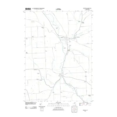
2011 Map of Moravia
USGS Topo · Published 2011About this map
Moravia and Locke serve as the primary population centers in this Southern Tier landscape, where the Owasco Inlet carves a path through the valley floor. The geography is defined by a series of named corners and rural settlements, including Toll Gate Corners, Perkins Corners, and Pine Hollow, illustrating the early 21st-century road network and land divisions. Genealogists will find a high density of burial sites, ranging from the Indian Mound Cemetery near Montville to the Old Quaker Cemetery and Old Settlers Cemetery. The terrain is marked by significant elevation changes at Oak Hill and Jewett Hill, with water features like Montville Falls and Parson Falls breaking the flow of the local creeks. Agricultural tracts like Grisamore Farms and Ancient Oaks Farm persist alongside modern infrastructure such as the Owasco Airport.
Find a feature on this map
85 named features on this map. Tap any name to fly to it.
Don’t see what you’re looking for? This feature index may not catch every label — zoom into the map to look around manually.
Map Details
Editions of this 2011 Moravia Map
This is the sole edition of this map. No revisions or reprints were ever made.
Other maps of this area

1898 · Moravia
USGS Topo · 1:62,500

1899 · Auburn
USGS Topo · 1:62,500

1899 · Skaneateles
USGS Topo · 1:62,500

1902 · Skaneateles
USGS Topo · 1:62,500

1902 · Moravia
USGS Topo · 1:62,500

1902 · Genoa
USGS Topo · 1:62,500

1902 · Auburn
USGS Topo · 1:62,500

1942 · Ludlowville
USGS Topo · 1:24,000

1942 · Groton
USGS Topo · 1:24,000

1942 · Genoa
USGS Topo · 1:24,000