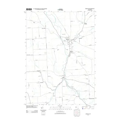
2013 Map of Moravia
USGS Topo · Published 2013About this map
Owasco Inlet flows through a broad valley floor, defining the landscape between the villages of Moravia and Locke. The geography is characterized by several watercourses descending from higher elevations, notably creating Parson Falls and Montville Falls. This 2013 survey provides a detailed look at the rural road network and localized hamlets such as Montville, Wilson Corners, and Goosetree. Genealogists will find a high density of burial grounds, including the Old Settlers Cem, Indian Mound Cem, and the Quaker and Catholic cemeteries near the primary settlements. The map also identifies agricultural properties like Ancient Oaks Farm and Morse Farm, alongside the local aviation facility at Owasco Airport. The presence of several family-named junctions, such as Satterly Corners and Shaw Corners, highlights the enduring legacy of early area families.
Find a feature on this map
125 named features on this map. Tap any name to fly to it.
Don’t see what you’re looking for? This feature index may not catch every label — zoom into the map to look around manually.
Map Details
Editions of this 2013 Moravia Map
This is the sole edition of this map. No revisions or reprints were ever made.
Other maps of this area

1898 · Moravia
USGS Topo · 1:62,500

1899 · Auburn
USGS Topo · 1:62,500

1899 · Skaneateles
USGS Topo · 1:62,500

1902 · Skaneateles
USGS Topo · 1:62,500

1902 · Moravia
USGS Topo · 1:62,500

1902 · Genoa
USGS Topo · 1:62,500

1902 · Auburn
USGS Topo · 1:62,500

1942 · Ludlowville
USGS Topo · 1:24,000

1942 · Groton
USGS Topo · 1:24,000

1942 · Genoa
USGS Topo · 1:24,000