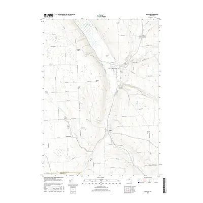
2016 Map of Moravia
USGS Topo · Published 2016About this map
Moravia and Locke serve as the primary hubs in this Finger Lakes region landscape, where the valley floor of Owasco Flats meets the surrounding uplands. The drainage of Owasco Inlet dictates the settlement pattern, drawing roads and residential clusters like Montville and Toll Gate Corners toward the water's edge. This 2016 survey documents a high density of small family and community burial grounds, including the Old Quaker Cem, Old Settlers Cem, and Baker Cem, which provide significant geographic clues for genealogical research. Natural landmarks such as Montville Falls and Parsons Falls highlight the dramatic elevation changes where Mill Creek and other tributaries descend toward the inlet. The map also records smaller hamlets and named crossroads like Wilson Corners, Chipman Corners, and Goosetree, preserving the distinct identities of these rural Cayuga County neighborhoods.
Find a feature on this map
98 named features on this map. Tap any name to fly to it.
Don’t see what you’re looking for? This feature index may not catch every label — zoom into the map to look around manually.
Map Details
Editions of this 2016 Moravia Map
This is the sole edition of this map. No revisions or reprints were ever made.
Other maps of this area

1898 · Moravia
USGS Topo · 1:62,500

1899 · Auburn
USGS Topo · 1:62,500

1899 · Skaneateles
USGS Topo · 1:62,500

1902 · Skaneateles
USGS Topo · 1:62,500

1902 · Moravia
USGS Topo · 1:62,500

1902 · Genoa
USGS Topo · 1:62,500

1902 · Auburn
USGS Topo · 1:62,500

1942 · Ludlowville
USGS Topo · 1:24,000

1942 · Groton
USGS Topo · 1:24,000

1942 · Genoa
USGS Topo · 1:24,000