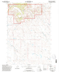
1993 Map of Moreau Peak
USGS Topo · Published 1996About this map
The East Short Pine Hills define this corner of Harding County, where the high-altitude terrain of the Custer National Forest rises abruptly from the plains. Centered on the landmark Moreau Peak, the landscape is deeply etched by a network of drainages including Ward Gulch and Adams Gulch, which feed into the Ash Coulee and Sand Creek systems below. This topography offered critical shelter and water in an otherwise arid environment, marked here by numerous numbered springs like Spring No 1 and Spring No 4.
Find a feature on this map
26 named features on this map. Tap any name to fly to it.
Don’t see what you’re looking for? This feature index may not catch every label — zoom into the map to look around manually.
Map Details
Editions of this 1993 Moreau Peak Map
This is the sole edition of this map. No revisions or reprints were ever made.
Other maps of this area

1935 · Harding
USGS Topo · 1:125,000

1954 · Lemmon
USGS Topo · 1:250,000

1957 · Lemmon
USGS Topo · 1:250,000

1973 · Lone Tree Draw West
USGS Topo · 1:24,000

1973 · Bog Creek
USGS Topo · 1:24,000

1973 · Redig
USGS Topo · 1:24,000

1973 · Hells Canyon
USGS Topo · 1:24,000
1977 · Harding
USGS Topo · 1:24,000
1978 · Redig NE
USGS Topo · 1:24,000
1978 · Alkali Creek West
USGS Topo · 1:24,000