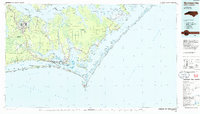
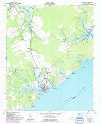
1985 Map of Morehead City
USGS Topo · Published 1985About this map
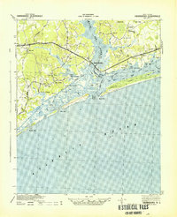
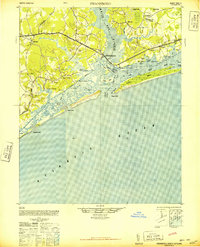
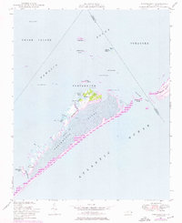
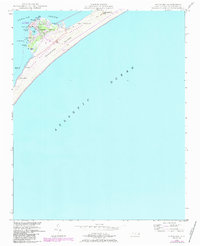
Bogue Banks and the barrier islands of the Core Banks define this coastal landscape, protecting a complex network of sounds and tidal marshes during the mid-1980s. The strategic positioning of Morehead City and Beaufort at the mouth of the Newport River highlights the region's historical dependence on maritime access, further emphasized by the route of the Southern railroad and the Intracoastal Waterway. To the west, the massive U.S. Marine Corps Air Station (Cherry Point) and the Croatan National Forest dominate the interior, while the eastern reaches are preserved within the Cape Lookout National Seashore. Small fishing and coastal communities such as Marshallberg, Smyrna, and Atlantic are scattered along the mainland's jagged edges, connected by Highway 70 as it winds toward Cedar Island National Wildlife Refuge.
Find a feature on this map
78 named features on this map. Tap any name to fly to it.
Don’t see what you’re looking for? This feature index may not catch every label — zoom into the map to look around manually.
Map Details
Editions of this 1985 Morehead City Map
This is the sole edition of this map. No revisions or reprints were ever made.
Other maps of this area

1901 · New Bern
USGS Topo · 1:62,500

1903 · New Bern
USGS Topo · 1:62,500

1942 · Maysville
USGS Topo · 1:62,500
1942 · Swansboro
USGS Topo · 1:62,500

1948 · Maysville
USGS Topo · 1:62,500
1948 · Swansboro
USGS Topo · 1:62,500
1948 · Portsmouth
USGS Topo · 1:24,000

1948 · North Bay
USGS Topo · 1:24,000
1948 · Ocracoke
USGS Topo · 1:24,000
1948 · Oriental
USGS Topo · 1:24,000