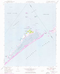
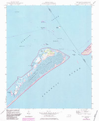
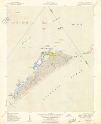
1948 Map of Portsmouth
USGS Topo · Published 1976About this map
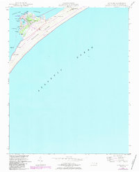
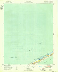
The isolated village of Portsmouth sits at the northern tip of Portsmouth Island, serving as a critical navigation point near the Ocracoke Inlet during the mid-20th century. This coastal landscape is defined by the shifting sands of the Cape Lookout National Seashore and its neighbor across the water, the Cape Hatteras National Seashore. The map highlights the intricate maritime infrastructure required to traverse Pamlico Sound, including the Wallace Channel Light and various beacons marking hazards like Shell Castle and Vera Cruz Shoal.
Find a feature on this map
37 named features on this map. Tap any name to fly to it.
Don’t see what you’re looking for? This feature index may not catch every label — zoom into the map to look around manually.
Map Details
Editions of this 1948 Portsmouth Map
2 editions found
Other maps of this area
1948 · Ocracoke
USGS Topo · 1:24,000
1950 · Howard Reef
USGS Topo · 1:24,000
1950 · Portsmouth
USGS Topo · 1:24,000

1953 · Rocky Mount
USGS Topo · 1:250,000

1953 · Beaufort
USGS Topo · 1:250,000

1954 · Rocky Mount
USGS Topo · 1:250,000

1954 · Beaufort
USGS Topo · 1:250,000
1955 · Wanchese
USGS Topo · 1:250,000
1957 · Manteo
USGS Topo · 1:250,000
1960 · Manteo
USGS Topo · 1:250,000