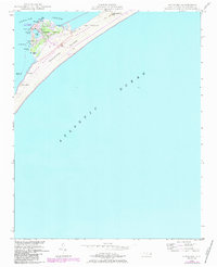
1948 Map of Ocracoke
USGS Topo · Published 1984About this map
Ocracoke serves as the focal point of this coastal study, situated at the southwestern tip of Ocracoke Island. The village is clustered around the protected waters of Silver Lake, showing a dense network of buildings and the historic Ocracoke Light standing near the sound side. The landscape transitions from the developed harbor to the expansive, sandy stretches of The Plains and the dunes of First Hammock Hills. Modern infrastructure like the Ocracoke Island Airport and a prominent Telephone Line are overlaid on the natural features of the Cape Hatteras National Seashore. Maritime navigation is well-documented through points like Windmill Point and Springers Point, while the interior marshes are dotted with small bodies of water such as Mary Anns Pond and Northern Pond. This document reflects a mid-century coastal community balancing its maritime heritage with increasing accessibility and national park status.
Find a feature on this map
24 named features on this map. Tap any name to fly to it.
Don’t see what you’re looking for? This feature index may not catch every label — zoom into the map to look around manually.
Map Details
Editions of this 1948 Ocracoke Map
2 editions found
Other maps of this area

1948 · Portsmouth
USGS Topo · 1:24,000

1950 · Howard Reef
USGS Topo · 1:24,000

1950 · Portsmouth
USGS Topo · 1:24,000
1950 · Green Island
USGS Topo · 1:24,000

1953 · Rocky Mount
USGS Topo · 1:250,000

1953 · Beaufort
USGS Topo · 1:250,000

1954 · Rocky Mount
USGS Topo · 1:250,000

1954 · Beaufort
USGS Topo · 1:250,000

1955 · Wanchese
USGS Topo · 1:250,000

1957 · Manteo
USGS Topo · 1:250,000