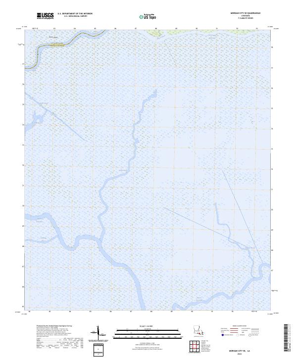
2024 Map of Morgan City SE
USGS Topo · Published 2024About this map
Avoca Island and the complex wetlands south of Morgan City define this coastal Louisiana landscape, where the boundary between St. Mary Parish and Terrebonne Parish winds through a dense network of waterways. The Intracoastal Waterway cuts across the northern reaches, serving as a primary artery for maritime traffic. This 2024 survey illustrates the contemporary hydrological patterns of the Atchafalaya Basin, showing how ancient drainage systems like Bayou Chene and Bayou Black interface with more modern engineering.
Find a feature on this map
15 named features on this map. Tap any name to fly to it.
Don’t see what you’re looking for? This feature index may not catch every label — zoom into the map to look around manually.
Map Details
Editions of this 2024 Morgan City SE Map
This is the sole edition of this map. No revisions or reprints were ever made.
Other maps of this area

1892 · Gibson
USGS Topo · 1:62,500

1894 · Bayou De Large
USGS Topo · 1:62,500

1897 · Gibson
USGS Topo · 1:62,500

1932 · Lake Decade
USGS Topo · 1:62,500

1935 · Morgan City
USGS Topo · 1:62,500

1935 · Lake Penchant
USGS Topo · 1:31,680

1939 · Gibson
USGS Topo · 1:62,500

1940 · Bayou Du Large
USGS Topo · 1:62,500

1941 · Bayou Du Large
USGS Topo · 1:62,500
1941 · Gibson
USGS Topo · 1:62,500