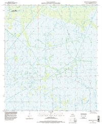
1994 Map of Morgan City SE
USGS Topo · Published 1998About this map
North Turtle Bayou Gas Field and the surrounding marshlands of south Louisiana define this landscape during the mid-1990s. This territory, situated along the boundary of St Mary Parish and Terrebonne Parish, is characterized by a complex network of industrial infrastructure superimposed on a delicate aquatic environment. The map details an extensive system of pipelines and drill sites integrated into the natural wetlands, illustrating the intensification of energy extraction in the Atchafalaya basin area.
Find a feature on this map
13 named features on this map. Tap any name to fly to it.
Don’t see what you’re looking for? This feature index may not catch every label — zoom into the map to look around manually.
Map Details
Editions of this 1994 Morgan City SE Map
This is the sole edition of this map. No revisions or reprints were ever made.
Other maps of this area

1892 · Gibson
USGS Topo · 1:62,500

1894 · Bayou De Large
USGS Topo · 1:62,500

1897 · Gibson
USGS Topo · 1:62,500

1932 · Lake Decade
USGS Topo · 1:62,500

1935 · Morgan City
USGS Topo · 1:62,500

1935 · Lake Penchant
USGS Topo · 1:31,680

1939 · Gibson
USGS Topo · 1:62,500

1940 · Bayou Du Large
USGS Topo · 1:62,500

1941 · Bayou Du Large
USGS Topo · 1:62,500
1941 · Gibson
USGS Topo · 1:62,500