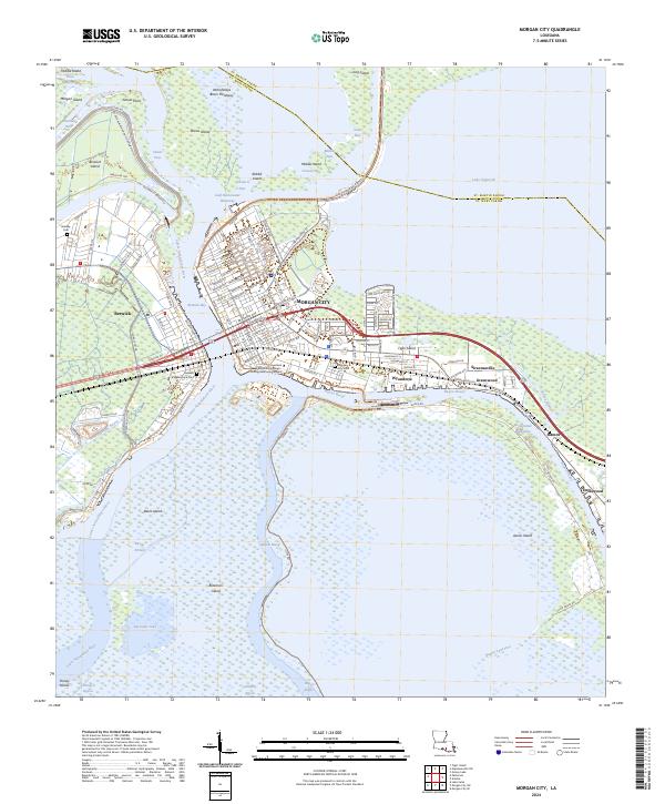
2024 Map of Morgan City
USGS Topo · Published 2024About this map
Morgan City and Berwick occupy a vital position at the junction of the Lower Atchafalaya River and Berwick Bay. This deltaic landscape is defined by its complex hydrology, where the Gulf Intracoastal Waterway cuts through a mosaic of marshland and bayous. The map captures the dense urban core of Morgan City, reaching from the riverfront to the shores of Lake Palourde. Educational and civic sites like the South Louisiana Community College - Young Memorial Campus and the Morgan City Cem reflect the community's established history.
Find a feature on this map
76 named features on this map. Tap any name to fly to it.
Don’t see what you’re looking for? This feature index may not catch every label — zoom into the map to look around manually.
Map Details
Editions of this 2024 Morgan City Map
This is the sole edition of this map. No revisions or reprints were ever made.
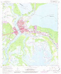
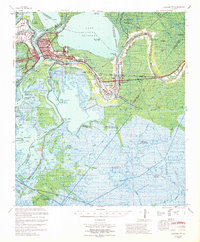
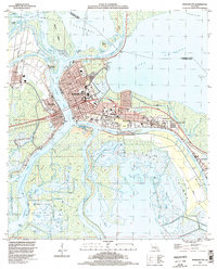
Historical Maps of Avoca Through Time
7 maps found