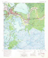
1967 Map of Morgan City
USGS Topo · Published 1969About this map
Morgan City and Berwick stand as the primary hubs of this Louisiana landscape, situated where the Lower Atchafalaya River meets the Intracoastal Waterway. The mid-1960s environment is defined by a complex network of bayous and lakes, including Lake Palourde and Sixmile Lake, which surround the sprawling industrial and residential areas of Tiger Island and Avoca Island. Smaller communities like Siracusaville, Greenwood, and Amelia are linked by the Southern Pacific railroad and U S Highway 90.
Find a feature on this map
60 named features on this map. Tap any name to fly to it.
Don’t see what you’re looking for? This feature index may not catch every label — zoom into the map to look around manually.
Map Details
Editions of this 1967 Morgan City Map
This is the sole edition of this map. No revisions or reprints were ever made.
Other maps of this area

1892 · Gibson
USGS Topo · 1:62,500

1892 · Thibodaux
USGS Topo · 1:62,500

1894 · Bayou De Large
USGS Topo · 1:62,500

1897 · Gibson
USGS Topo · 1:62,500

1932 · Lake Decade
USGS Topo · 1:62,500

1932 · Thibodaux SW
USGS Topo · 1:31,680

1935 · Morgan City
USGS Topo · 1:62,500

1935 · Lake Penchant
USGS Topo · 1:31,680

1938 · Labadieville
USGS Topo · 1:24,000

1939 · Gibson
USGS Topo · 1:62,500