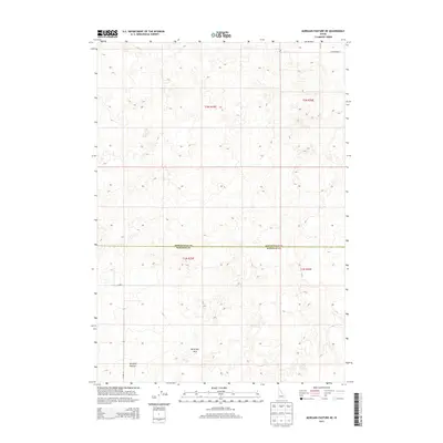
2013 Map of Morgans Pasture NE
USGS Topo · Published 2013About this map
Hells Half Acre dominates the southern landscape of this 2013 survey, representing a unique volcanic geological formation on the Snake River Plain. The area is characterized by sparse, undulating terrain across the border of Bonneville Co and Bingham Co. Human presence in this section of the High Desert is primarily defined by the rectilinear grid of the Public Land Survey System and a few arterial roads like W Broadway St in the northeast corner and E 1500 N further south. Local landmarks such as Morgans Pasture indicate the historical use of the land for seasonal grazing. This topographic record preserves the boundary between modern agricultural development and the ancient lava fields of the Idaho interior.
Find a feature on this map
9 named features on this map. Tap any name to fly to it.
Don’t see what you’re looking for? This feature index may not catch every label — zoom into the map to look around manually.
Map Details
Editions of this 2013 Morgans Pasture NE Map
This is the sole edition of this map. No revisions or reprints were ever made.
Other maps of this area

1948 · Woodville
USGS Topo · 1:24,000

1949 · Roberts
USGS Topo · 1:62,500

1949 · Shattuck Butte
USGS Topo · 1:24,000

1950 · Shattuck Butte
USGS Topo · 1:24,000

1950 · Woodville
USGS Topo · 1:24,000

1955 · Baldy Knoll
USGS Topo · 1:24,000

1955 · Rose
USGS Topo · 1:24,000

1955 · Firth
USGS Topo · 1:24,000

1955 · Idaho Falls
USGS Topo · 1:250,000

1958 · Idaho Falls
USGS Topo · 1:250,000