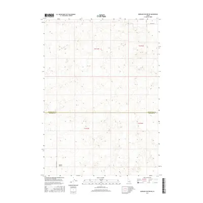
2017 Map of Morgans Pasture NE
USGS Topo · Published 2017About this map
Morgans Pasture defines this portion of the Idaho landscape along the border of Bonneville Co and Bingham Co. The terrain is characterized by a high-altitude agricultural and pastoral layout, structured by the Public Land Survey System grids of t2n r35e, t2n r36e, t1n r35e, and t1n r36e. This 2017 survey reveals a sparse settlement pattern, where infrastructure is limited to essential local connectors such as Morgans Pasture Rd in the southwest and W Broadway St in the northeast. The contour intervals illustrate a relatively flat plateau surface typical of the region's ranching land, showing how geographic features and county boundaries align with the rigid township and range lines of the American West.
Find a feature on this map
8 named features on this map. Tap any name to fly to it.
Don’t see what you’re looking for? This feature index may not catch every label — zoom into the map to look around manually.
Map Details
Editions of this 2017 Morgans Pasture NE Map
This is the sole edition of this map. No revisions or reprints were ever made.
Other maps of this area

1948 · Woodville
USGS Topo · 1:24,000

1949 · Roberts
USGS Topo · 1:62,500

1949 · Shattuck Butte
USGS Topo · 1:24,000

1950 · Shattuck Butte
USGS Topo · 1:24,000

1950 · Woodville
USGS Topo · 1:24,000

1955 · Baldy Knoll
USGS Topo · 1:24,000

1955 · Rose
USGS Topo · 1:24,000

1955 · Firth
USGS Topo · 1:24,000

1955 · Idaho Falls
USGS Topo · 1:250,000

1958 · Idaho Falls
USGS Topo · 1:250,000