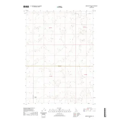
2020 Map of Morgans Pasture NE
USGS Topo · Published 2020About this map
Bonneville Co and Bingham Co meet along a straight east-west boundary line in this high desert landscape of eastern Idaho. The area is characterized by vast volcanic formations and agricultural grazing land, centered on the named settlement of Morgans Pasture. Modern infrastructure is sparse, with Morgans Pasture Rd providing the primary north-south access through the southern half of the map. In the northern section, W Broadway St skirts the edge of the survey area, reflecting the grid-based development typical of the region. The landscape is defined more by its township and range lines, such as t2n r35e and t1n r36e, than by dense settlement, illustrating the expansive nature of rural land management in the Snake River Plain vicinity.
Find a feature on this map
8 named features on this map. Tap any name to fly to it.
Don’t see what you’re looking for? This feature index may not catch every label — zoom into the map to look around manually.
Map Details
Editions of this 2020 Morgans Pasture NE Map
This is the sole edition of this map. No revisions or reprints were ever made.
Other maps of this area

1948 · Woodville
USGS Topo · 1:24,000

1949 · Roberts
USGS Topo · 1:62,500

1949 · Shattuck Butte
USGS Topo · 1:24,000

1950 · Shattuck Butte
USGS Topo · 1:24,000

1950 · Woodville
USGS Topo · 1:24,000

1955 · Baldy Knoll
USGS Topo · 1:24,000

1955 · Rose
USGS Topo · 1:24,000

1955 · Firth
USGS Topo · 1:24,000

1955 · Idaho Falls
USGS Topo · 1:250,000

1958 · Idaho Falls
USGS Topo · 1:250,000