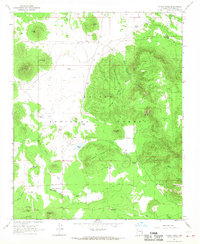
1966 Map of Moritz Ridge
USGS Topo · Published 1968About this map
Kaibab National Forest dominates this mid-century survey of the high Arizona plateau north of the San Francisco Peaks. The landscape is defined by volcanic features and high-altitude drainage systems, featuring distinct landmarks like Potato Hill, Sheep Hill, and the elevated terrain of Bull Mesa. The scarcity of permanent water is evident in the dense network of man-made and natural catchments scattered across the forest, including Drip Tank, Lost Spring Tank, and Moritz Lake.
Find a feature on this map
49 named features on this map. Tap any name to fly to it.
Don’t see what you’re looking for? This feature index may not catch every label — zoom into the map to look around manually.
Map Details
Editions of this 1966 Moritz Ridge Map
2 editions found
Other maps of this area

1886 · San Francisco Mtns
USGS Topo · 1:250,000

1886 · Chino
USGS Topo · 1:250,000

1891 · San Francisco Mtns
USGS Topo · 1:250,000

1891 · Chino
USGS Topo · 1:250,000

1894 · San Francisco Mtns
USGS Topo · 1:250,000

1899 · San Francisco Mtns
USGS Topo · 1:250,000

1908 · Flagstaff
USGS Topo · 1:125,000

1912 · Flagstaff
USGS Topo · 1:125,000

1922 · Williams
USGS Topo · 1:125,000

1947 · Flagstaff
USGS Topo · 1:250,000