
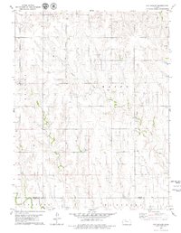
1979 Map of Morland
USGS Topo · Published 1979About this map
Morland serves as the central hub of this Graham County landscape, situated along the South Fork Solomon River and the Union Pacific railroad corridor. The settlement is defined by its transit and utility infrastructure, featuring a Radio Tower, Sewage Disposal Ponds, and a local Cem. Outside the town center, the terrain is shaped by an active resource economy, notably the extensive Solomon Oil Field that spans the central and southern portions of the territory. Numerous Oil Wells and a Quarry indicate the industrial priorities of the late 1970s. The drainage network is well-documented, with Antelope Creek feeding the river from the north, while Brush Creek and Jackson Branch navigate the southern townships of Gettysburg and Bryant. This map records a specific intersection of Great Plains agriculture, energy extraction, and small-town rail dependence.
Find a feature on this map
15 named features on this map. Tap any name to fly to it.
Don’t see what you’re looking for? This feature index may not catch every label — zoom into the map to look around manually.
Map Details
Editions of this 1979 Morland Map
This is the sole edition of this map. No revisions or reprints were ever made.
Other maps of this area

1893 · Hill
USGS Topo · 1:125,000

1954 · Goodland
USGS Topo · 1:250,000

1955 · Beloit
USGS Topo · 1:250,000

1956 · Goodland
USGS Topo · 1:250,000

1957 · Goodland
USGS Topo · 1:250,000

1959 · Beloit
USGS Topo · 1:250,000

1979 · Lucerne
USGS Topo · 1:24,000

1979 · Penokee
USGS Topo · 1:24,000

1979 · St Peter
USGS Topo · 1:24,000
1979 · Hay Hollow
USGS Topo · 1:24,000