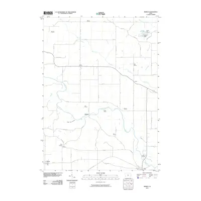
2010 Map of Morley
USGS Topo · Published 2010About this map
The Wapsipinicon River meanders through the heart of this Jones County landscape, creating distinctive features like Cedar Island and the valley known as Hogs Den Hollow. The 2010 survey highlights a predominantly agricultural and civic layout, anchored by the settlements of Morley, Olin, and Newport. For genealogists and local historians, the sheet is particularly valuable for its density of burial grounds, including the Midland Cemetery to the north, Antioch Cemetery near Bear Creek, and the dual Center Cemetery and Green Center Cemetery sites in the southwest. A notable civic presence is established by the Iowa State Penal Farm in the northwest corner, while the Fremont Mill Bridge near Central Park Lake serves as a reminder of early river crossings and milling infrastructure in the region.
Find a feature on this map
55 named features on this map. Tap any name to fly to it.
Don’t see what you’re looking for? This feature index may not catch every label — zoom into the map to look around manually.
Map Details
Editions of this 2010 Morley Map
This is the sole edition of this map. No revisions or reprints were ever made.
Other maps of this area

1889 · Tipton
USGS Topo · 1:62,500

1890 · Tipton
USGS Topo · 1:62,500

1890 · Anamosa
USGS Topo · 1:62,500

1891 · Monticello
USGS Topo · 1:62,500

1891 · Mechanicsville
USGS Topo · 1:62,500

1894 · Mechanicsville
USGS Topo · 1:62,500

1900 · Anamosa
USGS Topo · 1:125,000

1901 · Stanwood
USGS Topo · 1:125,000

1958 · Davenport
USGS Topo · 1:250,000

1959 · Dubuque
USGS Topo · 1:250,000