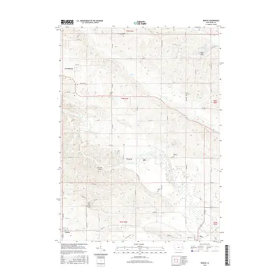
2015 Map of Morley
USGS Topo · Published 2015About this map
Bear Cr carves through the undulating rural landscape of Jones County, framing a corridor of small-town life and agricultural tradition. The northwestern corner reaches into the edge of Anamosa, while the town of Morley anchors the southern reaches and Olin sits at the southeastern edge of the survey. The mapping reveals a dense network of local history, marked by numerous small burial grounds such as Midland Cem, Artloch Cem, and the Green Center Cem. Notable landmarks like the Fremont Mill Bridge over Mineral Cr and the topographical feature Hogs Den Hollow offer specific points of interest for local researchers. The distribution of these cemeteries and named hollows suggests a long-settled rural community where family roots and small hamlets like Newport have persisted through the mid-2010s.
Find a feature on this map
49 named features on this map. Tap any name to fly to it.
Don’t see what you’re looking for? This feature index may not catch every label — zoom into the map to look around manually.
Map Details
Editions of this 2015 Morley Map
This is the sole edition of this map. No revisions or reprints were ever made.
Other maps of this area

1889 · Tipton
USGS Topo · 1:62,500

1890 · Tipton
USGS Topo · 1:62,500

1890 · Anamosa
USGS Topo · 1:62,500

1891 · Monticello
USGS Topo · 1:62,500

1891 · Mechanicsville
USGS Topo · 1:62,500

1894 · Mechanicsville
USGS Topo · 1:62,500

1900 · Anamosa
USGS Topo · 1:125,000

1901 · Stanwood
USGS Topo · 1:125,000

1958 · Davenport
USGS Topo · 1:250,000

1959 · Dubuque
USGS Topo · 1:250,000