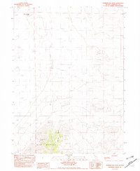
1982 Map of Mormon Dan Butte
USGS Topo · Published 1982About this map
Mormon Dan Butte rises above the arid expanse of Humboldt, Nevada, in this provisional survey that records the shifting terrain of the high desert. The map is defined by a massive field of Sand Dunes that stretch across the northern and central sections, illustrating the wind-swept environment before modern stabilization. In the southern reach, the topography shifts dramatically as the land ascends toward the peaks of Blue Mountain and Blue Mtn. Tucked within the rugged folds of the northern Canyon lies Barbara Worth Spring, a vital water source in an otherwise parched landscape. This 1982 edition serves as a record of these fragile desert features, documenting the isolation and geological character of this remote Nevada quadrangle during the late twentieth century.
Find a feature on this map
10 named features on this map. Tap any name to fly to it.
Don’t see what you’re looking for? This feature index may not catch every label — zoom into the map to look around manually.
Map Details
Editions of this 1982 Mormon Dan Butte Map
This is the sole edition of this map. No revisions or reprints were ever made.
Other maps of this area

1882 · Paradise
USGS Topo · 1:250,000

1886 · Disaster
USGS Topo · 1:250,000

1893 · Paradise
USGS Topo · 1:250,000

1893 · Disaster
USGS Topo · 1:250,000

1931 · Lovelock
USGS Topo · 1:250,000

1932 · Sonoma Range
USGS Topo · 1:250,000

1935 · Lovelock
USGS Topo · 1:250,000

1939 · Sonoma Range
USGS Topo · 1:250,000

1954 · Vya
USGS Topo · 1:250,000

1955 · McDermitt
USGS Topo · 1:250,000