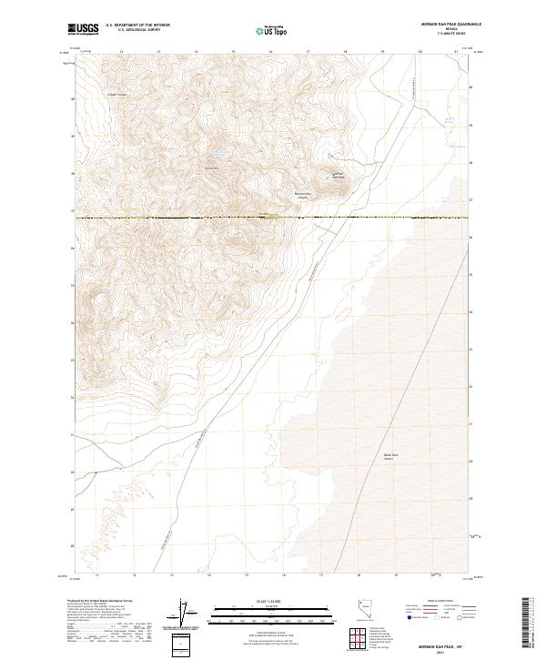
2021 Map of Mormon Dan Peak
USGS Topo · Published 2021About this map
Mormon Dan Peak dominates this high-desert terrain where the northwest corner of Black Rock Desert meets the rugged volcanic landscape of the Calico Hills. This 2021 survey traces the corridor of Soldier Meadows Rd as it cuts north through the boundary of Humboldt and Pershing counties, a vital artery through this arid region. The map reveals a series of water sources essential for desert travel and livestock, including Mormon Dan Spring, Whiskey Spring, and Barrel Spring. These names hint at the pioneer and ranching history that moved through the drainage of Mormon Dan Canyon and the surrounding basins. From the elevations of Copper Canyon to the alkali flats, the landscape is defined by its stark transitions and the sparse, vital network of named springs that supported life and movement between the mountain ranges.
Find a feature on this map
15 named features on this map. Tap any name to fly to it.
Don’t see what you’re looking for? This feature index may not catch every label — zoom into the map to look around manually.
Map Details
Editions of this 2021 Mormon Dan Peak Map
This is the sole edition of this map. No revisions or reprints were ever made.
Other maps of this area

1886 · Granite Range
USGS Topo · 1:250,000

1889 · Long Valley
USGS Topo · 1:250,000

1894 · Granite Range
USGS Topo · 1:250,000

1954 · Vya
USGS Topo · 1:250,000

1955 · Lovelock
USGS Topo · 1:250,000

1958 · Vya
USGS Topo · 1:250,000

1959 · Lovelock
USGS Topo · 1:250,000

1962 · Vya
USGS Topo · 1:250,000
1979 · Double Hot Springs
USGS Topo · 1:24,000
1980 · Division Peak
USGS Topo · 1:24,000