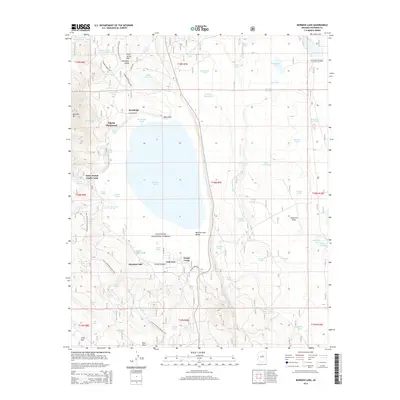
2014 Map of Mormon Lake
USGS Topo · Published 2014About this map
Mormon Lake dominates this high-elevation landscape within the Coconino National Forest, where a seasonal wetland environment creates a unique hydrology of named tanks and springs. The map shows a cluster of organized recreational and youth sites, including Saint Joseph Youth Camp, Pilgrim Playground, and Tempe Camp, suggesting the area's long-standing role as a summer retreat. Small residential nodes like Rockledge and Lakeview are perched near the lake's western and southern edges, connected by forest roads such as Rockledge Rd.
Find a feature on this map
85 named features on this map. Tap any name to fly to it.
Don’t see what you’re looking for? This feature index may not catch every label — zoom into the map to look around manually.
Map Details
Editions of this 2014 Mormon Lake Map
This is the sole edition of this map. No revisions or reprints were ever made.
Other maps of this area

1886 · San Francisco Mtns
USGS Topo · 1:250,000

1887 · Verde
USGS Topo · 1:250,000

1891 · San Francisco Mtns
USGS Topo · 1:250,000

1892 · Verde
USGS Topo · 1:250,000

1894 · San Francisco Mtns
USGS Topo · 1:250,000

1899 · San Francisco Mtns
USGS Topo · 1:250,000

1908 · Flagstaff
USGS Topo · 1:125,000

1912 · Flagstaff
USGS Topo · 1:125,000

1923 · Camp Verde
USGS Topo · 1:125,000

1932 · Camp Verde
USGS Topo · 1:125,000