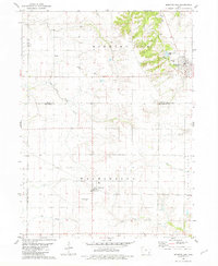
1981 Map of Morning Sun
USGS Topo · Published 1981About this map
Morning Sun sits at the intersection of local history and topography where the borders of Louisa and Des Moines counties meet. This 1981 edition, based on earlier 1970s aerial photography, reveals a landscape defined by small rail-era settlements and a complex drainage system. The town of Morning Sun features the Elmwood Cem on its eastern edge, while to the south, the village of Yarmouth is identified alongside a prominent Radio Tower and a nearby Landing Strip.
Find a feature on this map
18 named features on this map. Tap any name to fly to it.
Don’t see what you’re looking for? This feature index may not catch every label — zoom into the map to look around manually.
Map Details
Editions of this 1981 Morning Sun Map
This is the sole edition of this map. No revisions or reprints were ever made.
Other maps of this area

1934 · Burlington
USGS Topo · 1:48,000

1940 · Burlington
USGS Topo · 1:62,500

1946 · Wapello
USGS Topo · 1:62,500

1949 · Wapello
USGS Topo · 1:62,500

1958 · Burlington
USGS Topo · 1:250,000

1958 · Davenport
USGS Topo · 1:250,000

1961 · Burlington
USGS Topo · 1:250,000

1961 · Davenport
USGS Topo · 1:250,000

1962 · Davenport
USGS Topo · 1:250,000

1963 · Burlington
USGS Topo · 1:250,000