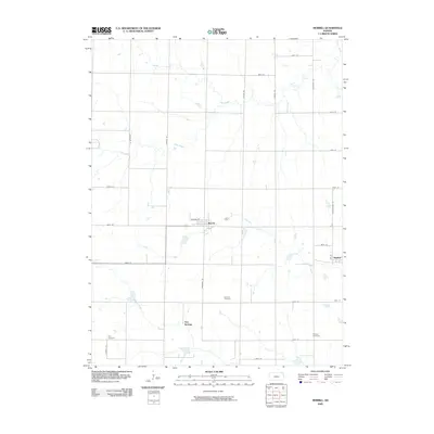
2009 Map of Morrill
USGS Topo · Published 2009About this map
The town of Morrill serves as the primary hub of this rural Kansas landscape, where a grid of section roads defines the agricultural character of Brown County. Settled along the northern edge of the state, the area is drained by a network of waterways including Pony Creek, Terrapin Creek, and Mulberry Creek. The small community of Sun Springs lies to the south of Morrill, while the village of Hamlin is situated near the eastern margin. For those researching local family histories, several burial grounds are preserved across the quadrangle, notably Dunkard Cemetery near the center, Isley Cemetery to the southwest, and Shelton Cemetery to the southeast. The map reflects a landscape deeply rooted in its original township surveys, with established farmsteads connected by thoroughfares such as Dewberry Rd and Grasshopper Rd.
Find a feature on this map
31 named features on this map. Tap any name to fly to it.
Don’t see what you’re looking for? This feature index may not catch every label — zoom into the map to look around manually.
Map Details
Editions of this 2009 Morrill Map
This is the sole edition of this map. No revisions or reprints were ever made.
Other maps of this area

1888 · Hiawatha
USGS Topo · 1:125,000

1894 · Hiawatha
USGS Topo · 1:125,000

1915 · Falls City
USGS Topo · 1:62,500

1916 · Humboldt
USGS Topo · 1:62,500

1950 · Kansas City
USGS Topo · 1:250,000

1954 · Kansas City
USGS Topo · 1:250,000

1955 · Nebraska City
USGS Topo · 1:250,000

1956 · Kansas City
USGS Topo · 1:250,000

1957 · Nebraska City
USGS Topo · 1:250,000

1958 · Nebraska City
USGS Topo · 1:250,000