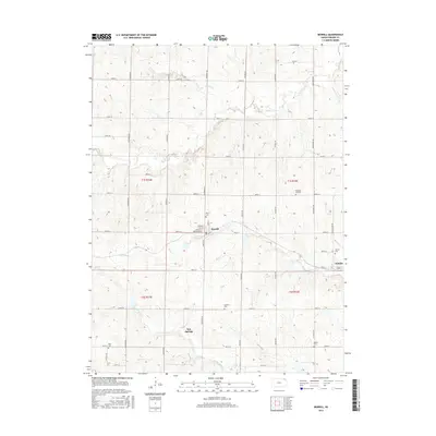
2016 Map of Morrill
USGS Topo · Published 2016About this map
Morrill and Hamlin anchor this agricultural landscape in Brown County, where a dense grid of rural roads connects several small settlements and family burial grounds. The township-and-range system is clearly defined here, with north-south thoroughfares like Goldfinch Rd and Falcon Rd crossing east-west section lines. Genealogy researchers will find significant value in the distribution of local cemeteries, including the Morrill Cem, Dunkard Cem, and the Pleasant Hill Cem near the northern boundary.
Find a feature on this map
43 named features on this map. Tap any name to fly to it.
Don’t see what you’re looking for? This feature index may not catch every label — zoom into the map to look around manually.
Map Details
Editions of this 2016 Morrill Map
This is the sole edition of this map. No revisions or reprints were ever made.
Other maps of this area

1888 · Hiawatha
USGS Topo · 1:125,000

1894 · Hiawatha
USGS Topo · 1:125,000

1915 · Falls City
USGS Topo · 1:62,500

1916 · Humboldt
USGS Topo · 1:62,500

1950 · Kansas City
USGS Topo · 1:250,000

1954 · Kansas City
USGS Topo · 1:250,000

1955 · Nebraska City
USGS Topo · 1:250,000

1956 · Kansas City
USGS Topo · 1:250,000

1957 · Nebraska City
USGS Topo · 1:250,000

1958 · Nebraska City
USGS Topo · 1:250,000