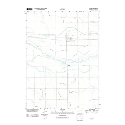
2011 Map of Morrill
USGS Topo · Published 2011About this map
Morrill serves as the primary hub of this high plains agricultural landscape, anchored by the Morrill Post Office and a grid of rural roads. The surrounding area in Scotts Bluff County is defined by an intricate network of irrigation systems necessary for prairie farming, including the Tri-State Canal, Ramshorn Canal, and Enterprise Canal. These man-made waterways parallel the North Platte River, which snakes through the center of the quadrangle alongside smaller settlements like South Morrill and Enterprise. For genealogists and local historians, the map identifies specific points of interest such as Forest Lawn Cemetery to the north and Caldwell Cemetery near the southern reaches. The terrain transitions from the river valley to the prominent height of Bald Peak, where the Bald Peak Group Detention Dam manages local water drainage across the West Bald Peak Lateral and East Bald Peak Lateral.
Find a feature on this map
49 named features on this map. Tap any name to fly to it.
Don’t see what you’re looking for? This feature index may not catch every label — zoom into the map to look around manually.
Map Details
Editions of this 2011 Morrill Map
This is the sole edition of this map. No revisions or reprints were ever made.
Other maps of this area

1896 · Patrick
USGS Topo · 1:125,000

1898 · Scotts Bluff
USGS Topo · 1:125,000

1899 · Goshen Hole
USGS Topo · 1:125,000

1899 · Whistle Creek
USGS Topo · 1:125,000

1954 · Scottsbluff
USGS Topo · 1:250,000

1954 · Torrington
USGS Topo · 1:250,000

1954 · Cheyenne
USGS Topo · 1:250,000

1955 · Alliance
USGS Topo · 1:250,000

1957 · Alliance
USGS Topo · 1:250,000

1958 · Cheyenne
USGS Topo · 1:250,000