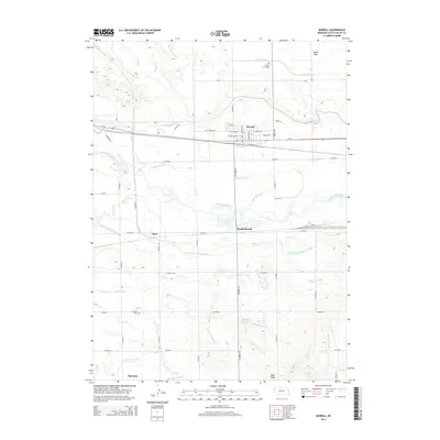
2014 Map of Morrill
USGS Topo · Published 2014About this map
The North Platte River defines the central geography of this Western Nebraska landscape, where an intricate network of irrigation projects sustains the high plains. The settlement of Morrill serves as a hub alongside the N Railway St and Us-26, supported by a complex system of waterways including the Tri-State Canal, Ramshorn Canal, and the Mitchell and Gering Canal. To the north, the terrain levels out into the Dutch Flats, while the south is marked by the prominence of Bald Peak. This survey provides a clear view of the rural infrastructure near the Wyoming border, documenting local landmarks like Forest Lawn Cem and Caldwell Cem. Smaller communities such as South Morrill, Joyce, and Hartman are situated along the rail and road corridors, illustrating the persistent connection between transportation and the region's managed water resources like the Lippencott Reservoir.
Find a feature on this map
46 named features on this map. Tap any name to fly to it.
Don’t see what you’re looking for? This feature index may not catch every label — zoom into the map to look around manually.
Map Details
Editions of this 2014 Morrill Map
This is the sole edition of this map. No revisions or reprints were ever made.
Other maps of this area

1896 · Patrick
USGS Topo · 1:125,000

1898 · Scotts Bluff
USGS Topo · 1:125,000

1899 · Goshen Hole
USGS Topo · 1:125,000

1899 · Whistle Creek
USGS Topo · 1:125,000

1954 · Scottsbluff
USGS Topo · 1:250,000

1954 · Torrington
USGS Topo · 1:250,000

1954 · Cheyenne
USGS Topo · 1:250,000

1955 · Alliance
USGS Topo · 1:250,000

1957 · Alliance
USGS Topo · 1:250,000

1958 · Cheyenne
USGS Topo · 1:250,000