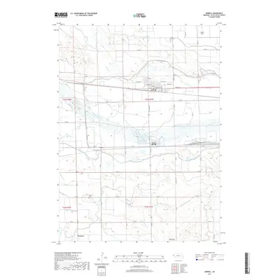
2017 Map of Morrill
USGS Topo · Published 2017About this map
Morrill stands as the primary hub of this Western Nebraska landscape, where the North Platte River and an intricate network of irrigation infrastructure dictate the layout of the land. In the early 21st century, the persistence of the region’s agricultural roots is evident in the extensive canal systems, including the Tri-State Canal, Mitchell and Gering Canal, and Ramshorn Canal, which branch out across the valley. These waterways support established settlements like South Morrill and Dutch Flats, as well as small localities such as Joyce and Hartman. The terrain is punctuated by significant landmarks like Bald Peak in the south and the quiet grounds of Forest Lawn Cem and Caldwell Cem. This detailed record shows how historical township lines and a rigid grid of county roads, such as Co RD F and Co RD B, have shaped the modern development of Scotts Bluff County.
Find a feature on this map
43 named features on this map. Tap any name to fly to it.
Don’t see what you’re looking for? This feature index may not catch every label — zoom into the map to look around manually.
Map Details
Editions of this 2017 Morrill Map
This is the sole edition of this map. No revisions or reprints were ever made.
Other maps of this area

1896 · Patrick
USGS Topo · 1:125,000

1898 · Scotts Bluff
USGS Topo · 1:125,000

1899 · Goshen Hole
USGS Topo · 1:125,000

1899 · Whistle Creek
USGS Topo · 1:125,000

1954 · Scottsbluff
USGS Topo · 1:250,000

1954 · Torrington
USGS Topo · 1:250,000

1954 · Cheyenne
USGS Topo · 1:250,000

1955 · Alliance
USGS Topo · 1:250,000

1957 · Alliance
USGS Topo · 1:250,000

1958 · Cheyenne
USGS Topo · 1:250,000