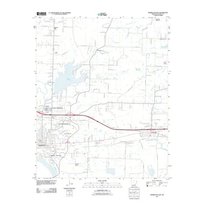
2011 Map of Morrilton East
USGS Topo · Published 2011About this map
Morrilton and Plumerville anchor this eastern Conway County landscape, which transitions from the northern highlands of Ragsdale Mountain and Burrow Mountain down toward the Arkansas River. This corridor reflects a century of transport evolution, where the Union Pacific railroad and Interstate 40 run parallel, tracing the historic route through the Arkansas River Valley. The area is heavily defined by mid-century water management, notably Lake Overcup and its associated Lake Overcup Dam, alongside the eastern reach of Brewer Lake. Local heritage is preserved in numerous scattered burial grounds, including the historic Lewisburg Cemetery near the river and the Sacred Heart Cemetery in the north. Settlement patterns show modern growth in the North Hills Subdivision and Northview Subdivision, while older communities like Lewisburg and Hickory Hill maintain their place in the rural fabric. The presence of the Morrilton Municipal Airport and the Morrilton Post Office marks the city's role as a regional hub.
Find a feature on this map
142 named features on this map. Tap any name to fly to it.
Don’t see what you’re looking for? This feature index may not catch every label — zoom into the map to look around manually.
Map Details
Editions of this 2011 Morrilton East Map
This is the sole edition of this map. No revisions or reprints were ever made.
Other maps of this area

1889 · Morrilton No. 3
USGS Topo · 1:62,500

1892 · Morrillton
USGS Topo · 1:125,000

1894 · Morrillton
USGS Topo · 1:125,000

1956 · Russellville
USGS Topo · 1:250,000

1961 · Menifee
USGS Topo · 1:24,000

1961 · Perryville
USGS Topo · 1:24,000

1961 · Morrilton East
USGS Topo · 1:24,000

1961 · Morrilton West
USGS Topo · 1:24,000

1961 · Houston
USGS Topo · 1:24,000

1961 · Gleason
USGS Topo · 1:24,000