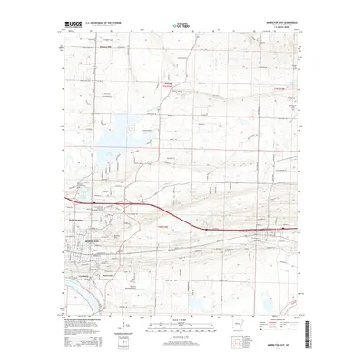
2014 Map of Morrilton East
USGS Topo · Published 2014About this map
The Arkansas River defines the southern reach of this Conway County landscape, where the historic riverfront at Lewisburg meets the modern infrastructure of Morrilton. This area reveals a transition from the river-bottom lands of Miller Bayou to the rising terrain of Burrow Mtn. The transport corridor is dominated by the Union Pacific rail line and local highways that link Plumerville to the regional center of Morrilton. Educational and civic life is anchored by the University of Arkansas Community College-Morrilton, while numerous local landmarks like Sacred Heart Cem and Oak Grove Cem offer points of interest for genealogists. Further north, the landscape opens toward Lake Overcup and the rural settlements of Overcup and Hickory Hill, showing the evolution of the county from river-dependent commerce to its early 21st-century residential and institutional layout.
Find a feature on this map
117 named features on this map. Tap any name to fly to it.
Don’t see what you’re looking for? This feature index may not catch every label — zoom into the map to look around manually.
Map Details
Editions of this 2014 Morrilton East Map
This is the sole edition of this map. No revisions or reprints were ever made.
Other maps of this area

1889 · Morrilton No. 3
USGS Topo · 1:62,500

1892 · Morrillton
USGS Topo · 1:125,000

1894 · Morrillton
USGS Topo · 1:125,000

1956 · Russellville
USGS Topo · 1:250,000

1961 · Menifee
USGS Topo · 1:24,000

1961 · Perryville
USGS Topo · 1:24,000

1961 · Morrilton East
USGS Topo · 1:24,000

1961 · Morrilton West
USGS Topo · 1:24,000

1961 · Houston
USGS Topo · 1:24,000

1961 · Gleason
USGS Topo · 1:24,000