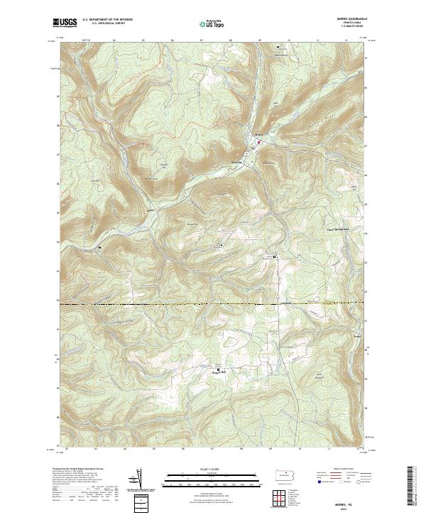
2023 Map of Morris
USGS Topo · Published 2023About this map
Babb Creek winds through the heart of this North-Central Pennsylvania landscape, where the settlements of Morris and Hoytville occupy the valley floor. The map records a geography defined by its deep hollows and high points like Texas Mountain and Bald Hill, reflecting a long history of upland agriculture and valley industry. Local genealogists will find several burial grounds documented across the terrain, from Antrim Cem in the north to Hill Cem at Oregon Hill. The transition between Tioga Co and Lycoming Co is clearly marked as it passes through Lorenton. Significant named landmarks like Devils Elbow and The Horn provide specific geographic anchors for those tracing property boundaries or family history in this corner of the state forest region.
Find a feature on this map
96 named features on this map. Tap any name to fly to it.
Don’t see what you’re looking for? This feature index may not catch every label — zoom into the map to look around manually.
Map Details
Editions of this 2023 Morris Map
This is the sole edition of this map. No revisions or reprints were ever made.
Other maps of this area

1921 · Trout Run
USGS Topo · 1:62,500

1923 · Trout Run
USGS Topo · 1:62,500

1925 · Blossburg
USGS Topo · 1:62,500

1927 · Blossburg
USGS Topo · 1:62,500

1937 · Waterville
USGS Topo · 1:48,000

1943 · Waterville
USGS Topo · 1:62,500

1944 · Blossburg
USGS Topo · 1:62,500

1944 · Trout Run
USGS Topo · 1:62,500

1946 · Tiadaghton
USGS Topo · 1:24,000

1946 · Antrim
USGS Topo · 1:62,500
Featured Places
- Morris Township, PA
- Duncan Township, PA
- Hoytville, Morris Township
- Pine Township, PA
- Lorenton, Morris Township