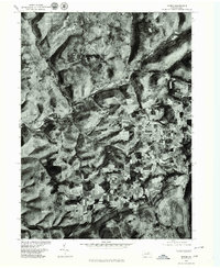
1977 Map of Morris
USGS Topo · Published 1979About this map
Babb Creek and Pine Creek converge in this section of Tioga County, where the settlement of Morris sits at the base of the surrounding highlands. This orthophotoquad, produced from 1977 aerial photography, reveals a landscape defined by the sharp contrast between narrow, winding stream valleys and the broad, cleared agricultural plateaus of Oregon Hill. The image detail captures the precise footprint of small communities like Mt Pleasant and the isolated enclave of Doan, showing how development has followed the topography of the creek beds. For those studying Pennsylvania's rural history, the map provides an exact visual record of field patterns, woodlots, and transport routes as they existed in the late 1970s, before modern reforestation or land-use changes altered these traditional farming and timber corridors.
Find a feature on this map
6 named features on this map. Tap any name to fly to it.
Don’t see what you’re looking for? This feature index may not catch every label — zoom into the map to look around manually.
Map Details
Editions of this 1977 Morris Map
This is the sole edition of this map. No revisions or reprints were ever made.
Other maps of this area

1921 · Trout Run
USGS Topo · 1:62,500

1923 · Trout Run
USGS Topo · 1:62,500

1925 · Blossburg
USGS Topo · 1:62,500

1927 · Blossburg
USGS Topo · 1:62,500

1937 · Waterville
USGS Topo · 1:48,000

1943 · Waterville
USGS Topo · 1:62,500

1944 · Blossburg
USGS Topo · 1:62,500

1944 · Trout Run
USGS Topo · 1:62,500

1946 · Tiadaghton
USGS Topo · 1:24,000

1946 · Antrim
USGS Topo · 1:62,500
Featured Places
- Morris Township, PA
- Duncan Township, PA
- Brown Township, PA
- Pine Township, PA
- Mount Pleasant, Morris Township