
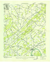
1935 Map of Morristown
USGS Topo · Published 1935About this map
Morristown serves as the focal point of this mid-1930s landscape, where the Southern Railway corridor and U S Highway No 11 E converge amidst a dense network of local landmarks. The map captures a transition in rural Tennessee life, documented by the Tennessee Valley Authority through aerial photography and field examinations. To the east, the Fair Grounds and CCC Camp No 1467 reflect the era's public works and community gatherings, while the surrounding countryside is dotted with neighborhood anchors like Manley Memorial Ch and Reed Chapel. The terrain transitions from the Holston River in the north toward the Bays Mountains in the southeast, revealing a landscape defined by small settlements like Roe Junction and Valley Home. Numerous family-named landmarks and cemeteries, such as Emma Jarnagan Cem and Crockett, provide vital data for genealogical research into the Hamblen and Jefferson County borderlands.
Find a feature on this map
71 named features on this map. Tap any name to fly to it.
Don’t see what you’re looking for? This feature index may not catch every label — zoom into the map to look around manually.
Map Details
Editions of this 1935 Morristown Map
This is the sole edition of this map. No revisions or reprints were ever made.
Other maps of this area

1883 · Morristown
USGS Topo · 1:125,000

1893 · Morristown
USGS Topo · 1:125,000

1895 · Morristown
USGS Topo · 1:125,000

1935 · White Pine
USGS Topo · 1:24,000

1935 · Rogersville
USGS Topo · 1:48,000

1935 · Tate Springs
USGS Topo · 1:48,000

1935 · Springvale
USGS Topo · 1:24,000

1935 · Avondale
USGS Topo · 1:24,000

1935 · Russellville
USGS Topo · 1:24,000
1935 · Jefferson City
USGS Topo · 1:24,000