
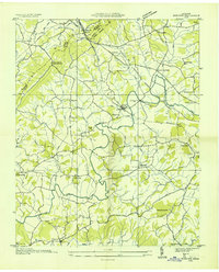
1935 Map of Russellville
USGS Topo · Published 1935About this map
Holston River meanders sharply through the heart of this Tennessee landscape, its course punctuated by large river islands like Bingham Island and Cobb Island. The river serves as a natural divide between Hawkins Co and Hamblen Co, while its banks are dotted with evidence of an early 20th-century water-based economy, including the Bright Ferry crossing and Halls Ford. In the southern reaches, the Southern Railway corridor anchors the settlements of Whitesburg and Russellville, where the Andrew Johnson Highway follows the rail line through the valley.
Find a feature on this map
64 named features on this map. Tap any name to fly to it.
Don’t see what you’re looking for? This feature index may not catch every label — zoom into the map to look around manually.
Map Details
Editions of this 1935 Russellville Map
This is the sole edition of this map. No revisions or reprints were ever made.
Other maps of this area

1883 · Morristown
USGS Topo · 1:125,000

1893 · Morristown
USGS Topo · 1:125,000

1895 · Morristown
USGS Topo · 1:125,000

1935 · Rogersville
USGS Topo · 1:48,000

1935 · Tate Springs
USGS Topo · 1:48,000

1935 · Lee Valley
USGS Topo · 1:24,000

1935 · Springvale
USGS Topo · 1:24,000

1935 · Swan Island
USGS Topo · 1:24,000

1935 · Morristown
USGS Topo · 1:24,000
1935 · Mohawk
USGS Topo · 1:24,000